BAMUSSO COUNCIL
Informations générales
|
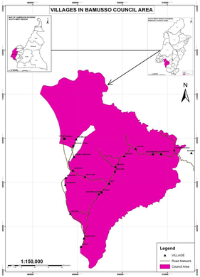
Date of creation : 1957 Website : Adress : Contact : Location : Bamusso is located some 25km from Mbonge and has a total surface area of about 885km2 with a population living in 27 villages. It is located between latitude 4033’N and longitude 9001’E with an altitude of about 80m in the mainland area above sea level and -5m in the maritime area which is below sea level. The Bamusso municipality has geographical boundaries with :
The average temperature range is about 300C and mean monthly rainfall of about 2500mm to 5000mm. History : |

Dirigeants successifs
Maires
| Période | Nom et prénoms | Profession | Parti |
| 2020-2020 | Samuel MEME MEME | RDPC | |
| 2013- 2019 | Mme ETONGO Grace MBENG | RDPC | |
| 2007-2013 | SANGI Emmanuel NJABA | ||
| 2002-2007 | Gabriel EYESA ETONGO | ||
| 1995-2002 |
Secrétaires généraux
| Période | Nom et prénoms |
| 2019- | |
| xxxx-2019 | |
| xx-2005 | Ferdinand MVO ETTIA |
Adjoints
| Période | N° | Nom et prénoms | Parti |
| 2020- | A1 | ||
| A2 | |||
| 2013- 2020 | A1 | FETE Joseph LENYA | RDPC |
| A2 | Samuel MEME MEME | ||
| 2007-2013 | A1 | Fabian OTTE BEBE | |
| A2 | Charles METUGE EPIE | ||
| 2002-2007 | A1 | ||
| A2 | |||
Plans, Stratégies, Patrimoine
Stratégies, Plans et Projets
| Dénomination |
Date début |
Date fin |
| Plan Communal de Developpement | ||
Partenaires
| Dénomination | Objet |
Date début |
Date fin |
| Ministère de l'Habitat et du Dévéloppement Urbain (MINHDU) | |||
| Ministère de la Décentralisation | |||
| FEICOM (Fonds Spécial d'Equipement et d'Intervention Intercommunal) | |||
| CVUC (Communes et Villes Unies du Cameroun) | |||
| PNDP (Programme National de Développement Participatif) | |||
| Réalisation du PCD | 2015 |
Associations partenaires
| Nom | Objet | Lieu | Date ouverture |
| / |
Patrimoine de la Commune
| Dénomination |
Date création ou de partenariat |
| Mokoko Forest Reserve | |
Les grandes réalisations qui changent la ville
| Dénomination |
Date début |
Date réception |
Evènements
| Evènement | Type | Date 1ère éd. | Périod. |
Prix et distinctions
| Dénomination | Date |
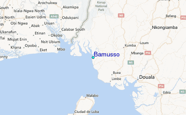
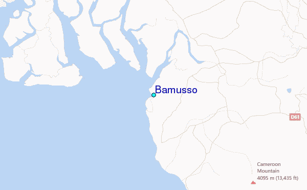
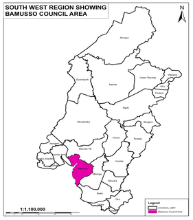
Localisation de Bamusso

Biophysical environment
The Bamusso municipality is being sub divided into two zones i.e. the maritime and the mainland area with two distinct biophysical environments.
-
The maritime area which comprises of about 11 villages is surrounded by an evergreen mangrove ecosystem forest with high variety of biodiversity. Accessibility to villages in
the area is through the creeks or by high sea like in the case of the Island of Bamusso and the peninsular of Bekumu.
Three quarter of the surface area is below sea level with an altitude of about -1m to -5m. The area is highly risky during the raining season due to the swampy nature of the area. -
The mainland area is covered by an ever green forest vegetation and a savannah vegetation with some of the villages located within the creek such as Dikome-Bekiri, Boa and
Bekaraka also have spatial distribution of the mangrove ecosystem. The savannah vegetation is found within the villages of Ekombe Liongo and Ekombe Waterfall.
The Mokoko forest reserve stretches within the boundaries Illoani which is a fast developing to an urban area. G
enerally being found on the leeway side of the Mount Cameroon, the topography is level land/ plain. This greatly account for the reason for the location of the Cameroon Development Cooperation (CDC) in the Main land area of Illoani and the Boa plain.
Economie
Principales entreprises installées
| Dénomination | Date |
Education, Santé
| Carte scolaire de la Maternelle et du Primaire |
| Carte scolaire du Secondaire |
| Carte de l'Enseignement supérieur |
| Carte de la Formation professionnelle |
| Carte sanitaire de la Commune |
|
Année |
Nbre de partis |
Nb conseil |
Budget en FCFA |
Pop |
Effectif | Etat civil | |||
| Elus | Employés | Naiss | Mari. | Décès | |||||
| 2014 | |||||||||
| 2013 | |||||||||
| 2012 | |||||||||
| 2011 | |||||||||
| 2010 | |||||||||
| 2009 | |||||||||
Documentation
Documents d'organisation
Etudes, Rapports
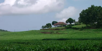
Images d'hier et d'aujourd'hui